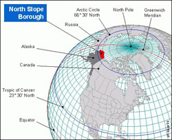
Map: Alaska's North Slope
Associated Article Details
|
ExxonMobil Successfully Drills Point Thomson Wells in Alaska Wednesday, October 27, 2010 - ExxonMobil has successfully drilled and tested the PTU-15 and PTU-16 development wells for the Point Thomson project on Alaska's North Slope, ahead of the year-end 2010 target. << back to article |
|
|
| Image Description and Attributes | |
| Image Description: | Alaska's North Slope |
| Keywords: | Alaska North Slope |
| Type of Image: | Map |
| Dimensions: | 250 pixels wide by 203 pixels tall |
| Date Created: | Monday, August 7, 2006 |
| Associated Regional Information | |
| Region: | United States (view more from this region) |
| Country: | US (view more from this country) |
| Articles Associated with this Image/Map: | |
|
- MMS Issues Proposal for Next Federal Beaufort Sea Lease Sale
[Friday, October 27, 2006]
- Interior Report Finds Broad Access Restrictions on Federal Lands [Wednesday, November 29, 2006] - Fox Petroleum Finds Prime Position on Alaska's North Slope [Thursday, July 12, 2007] - Fox Petroleum Completes North Slope Acquisition [Tuesday, August 14, 2007] - ExxonMobil Successfully Drills Point Thomson Wells in Alaska [Wednesday, October 27, 2010] |
|